India’s national expressway network has expanded considerably over the past few years. Under the Bharatmala Pariyojana, the National Highways Authority of India is building and completing access-controlled corridors that connect metros, Tier-2 cities, and industrial zones across the country. Several of these projects are at advanced stages in 2026, either fully operational or nearing completion.
This article covers the major new expressways set to advance in 2026, including their routes, key cities, infrastructure specifications, and observed trends in property markets along these corridors.
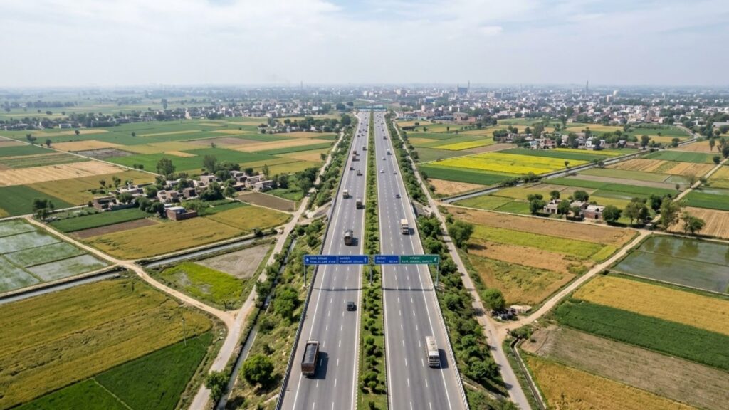
Table of Contents
Major New Expressway Projects in 2026
Delhi-Mumbai Expressway (NH-148N)
The Delhi-Mumbai Expressway spans approximately 1,386 km and is one of the longest access-controlled road projects in the country. It originates near Sohna in Haryana and passes through Rajasthan, Madhya Pradesh, and Gujarat before ending at JNPT near Navi Mumbai.
Key cities along the route include Gurugram, Jaipur, Dausa, Ratlam, Vadodara, and Surat. Construction has progressed in phases. The Dausa to Vadodara segment reached completion in early 2026. Full operations across the corridor are expected to follow.
The road is designed for a speed of 120 km/h and includes EV charging infrastructure, smart traffic management systems, and wayside amenities at regular intervals.
Delhi-Amritsar-Katra Expressway
This corridor runs approximately 670 km from Bahadurgarh on the Delhi-Haryana border, passing through Haryana and Punjab. Near Nakodar, the route splits into two alignments. One branch connects to Amritsar International Airport. The other continues through Gurdaspur toward Katra, the base town for the Vaishno Devi pilgrimage.
Cities covered along the route include Karnal, Jalandhar, Nakodar, Tarn Taran, and Gurdaspur. The expressway is targeted for full operations in 2026.
Bengaluru-Chennai Expressway
The Bengaluru-Chennai Expressway is a greenfield project spanning approximately 262 km. It begins at Hoskote near Bengaluru and passes through Kolar district in Karnataka, crosses into Andhra Pradesh near Palamaner and Chittoor, and ends at Sriperumbudur on the outskirts of Chennai.
Once operational, it is expected to reduce road travel time between the two cities to approximately two to three hours. Sriperumbudur on the Chennai end has existing manufacturing and industrial activity. The Hoskote end connects to Bengaluru’s eastern periphery.
Purvanchal Expressway
The Purvanchal Expressway is fully operational. It runs approximately 341 km from Chand Saray in Lucknow to Haidaria near Ghazipur, passing through Barabanki, Amethi, Sultanpur, Ayodhya, Azamgarh, and Mau.
This corridor has significantly improved road connectivity for Eastern Uttar Pradesh, a region that previously lacked modern highway infrastructure. Ayodhya, which has seen growth in pilgrimage and tourism activity, now has direct expressway access to Lucknow.
Ganga Expressway
The Ganga Expressway is under construction and spans approximately 594 km from Meerut to Prayagraj. The route passes through Hapur, Bulandshahr, Amroha, Sambhal, Shahjahanpur, Hardoi, and Unnao. It traverses several districts in western and central Uttar Pradesh.
The project is targeting key completion milestones in 2026. When operational, it will provide a continuous expressway connection from western UP through the Ganga plains to Prayagraj.
Pune-Aurangabad (Samruddhi Extension)
The Pune-Aurangabad corridor is progressing as part of the wider Maharashtra expressway development. It will link Pune to Aurangabad, which already connects to Mumbai via the Mumbai-Nagpur Samruddhi Mahamarg. Aurangabad has an established industrial base in automotive and pharmaceutical manufacturing, which influences the type of infrastructure activity along this route.
Expressway Route Summary
| Expressway | Length (Approx.) | Start to End | Key Cities on Route |
|---|---|---|---|
| Delhi-Mumbai | 1,386 km | Sohna to JNPT Navi Mumbai | Gurugram, Jaipur, Dausa, Vadodara, Surat |
| Delhi-Amritsar-Katra | 670 km | Bahadurgarh to Katra | Jalandhar, Nakodar, Amritsar, Gurdaspur |
| Bengaluru-Chennai | 262 km | Hoskote to Sriperumbudur | Kolar, Palamaner, Chittoor |
| Purvanchal | 341 km | Lucknow to Ghazipur | Ayodhya, Sultanpur, Azamgarh, Mau |
| Ganga | 594 km | Meerut to Prayagraj | Bulandshahr, Shahjahanpur, Hardoi, Unnao |
Infrastructure Specifications
Road Design and Lane Configuration
- Four to eight lanes, with land acquisition done for future expansion on most corridors
- Access-controlled design with entry and exit only at designated interchanges
- Grade-separated intersections at all major junctions
- 120 km/h design speed on most Bharatmala expressways
Amenities and Support Systems
- Wayside amenity complexes with fuel, food, and rest facilities at intervals of approximately 50 km
- EV charging stations being installed at select amenity plazas
- CCTV coverage and incident detection systems along the main carriageway
- Emergency response lanes and patrol vehicles on operational stretches
Greenfield vs Brownfield Classification
Expressway projects under Bharatmala fall into two categories. Greenfield projects, such as the Bengaluru-Chennai Expressway, are built on entirely new alignments with no prior road. Brownfield projects involve upgrading or widening existing national highways. Greenfield corridors generally pass through less-developed land, while brownfield upgrades tend to run through areas with existing economic activity.
Property Markets Along Expressway Corridors
NCR: Dwarka Expressway and Yamuna Expressway
Dwarka Expressway, now fully operational within the National Capital Region, has seen residential development activity increase over the past several years in areas like Sector 99 to Sector 115 of Gurugram. End-user and buyer activity has grown, and the corridor now hosts multiple mid-segment and upper-mid-segment housing projects.
Yamuna Expressway connects Greater Noida to Agra. The proposed Noida International Airport at Jewar along this corridor has increased interest in surrounding land. Industrial and logistics development has been active in the Greater Noida and Jewar belt. Residential project activity has also increased, particularly for plotted developments and township formats.
Uttar Pradesh: Purvanchal and Agra-Lucknow Corridors
The Purvanchal and Agra-Lucknow new expressways have improved road access for several Tier-2 cities in Uttar Pradesh. Ayodhya has seen increased commercial and residential development activity, supported by religious tourism growth and the expressway connection to Lucknow. Mathura, along the Agra-Lucknow corridor, has seen property interest grow for similar reasons.
Towns like Sultanpur, Azamgarh, and Unnao, while still in early stages, are receiving attention from developers for plotted residential formats in the affordable segment.
South India: Bengaluru-Chennai Corridor
- Kolar district in Karnataka is receiving developer inquiries for residential and plotted projects
- Hoskote near Bengaluru has seen growth in warehousing and logistics land transactions
- Sriperumbudur on the Chennai end has an established manufacturing base; the expressway adds road access to complement existing connectivity
- Chittoor and Palamaner in Andhra Pradesh are early in the development cycle, with land values at lower levels relative to urban centres
Western India: Pune-Aurangabad and Sohna
Aurangabad’s proximity to established automotive and pharmaceutical manufacturing clusters means that warehousing and logistics demand is present independently of the expressway. The Pune-Aurangabad corridor will add road connectivity, which is expected to increase the range of residential and commercial development options between the two cities.
Sohna in Haryana, at the originating end of the Delhi-Mumbai Expressway, has seen increased plotted development and light industrial land activity. It is relatively accessible from central Gurugram and sits on the main expressway alignment.
Types of Expressways Under Bharatmala
| Type | Description | Example |
|---|---|---|
| Greenfield | New alignment on previously undeveloped land | Bengaluru-Chennai Expressway |
| Brownfield | Upgrade or widening of an existing national highway | Several NH corridors under Bharatmala Phase 1 |
| Access-Controlled | Entry and exit restricted to designated interchanges only | Delhi-Mumbai Expressway, Yamuna Expressway |
Conclusion
India’s new expressways network is progressing across multiple corridors under the Bharatmala Pariyojana. Projects range from fully operational stretches like the Purvanchal Expressway to greenfield alignments like the Bengaluru-Chennai corridor nearing completion.
Property markets along these corridors show increased activity in residential, plotted, and logistics segments. The scale of this activity varies by location and distance from interchange exits. For current listings near these corridors, Search verified properties on Openplot.com.
Frequently Asked Questions
Which expressways are expected to be fully operational in 2026?
The Delhi-Amritsar-Katra Expressway is expected to be fully operational by 2026. The Delhi-Mumbai Expressway is expected to complete remaining segments and open across its full length around the same period. The Ganga Expressway is also targeting major construction milestones in 2026, though full operations may follow in a subsequent phase.
What is the difference between a greenfield and a brownfield expressway?
A greenfield expressway is built on a new alignment, typically through land that has not previously had road infrastructure. A brownfield expressway is developed by upgrading, widening, or realigning an existing road. Greenfield projects often pass through lower-cost land in less-developed zones, while brownfield upgrades tend to run through areas with existing settlements and commercial activity.
How does expressway access affect property values in nearby areas?
Expressways reduce travel time between cities and improve freight movement. This tends to increase demand for residential, commercial, and logistics-use land near interchange exits. Property market changes vary by location, distance from interchanges, and the existing development status of the area. Land near newly announced interchanges generally attracts developer interest before a road opens, while localities farther from exits see more limited direct effect.
What is the Bharatmala Pariyojana?
Bharatmala Pariyojana is a central government road infrastructure programme administered through the National Highways Authority of India (NHAI) and the Ministry of Road Transport and Highways. Phase 1 covers the construction and upgrade of approximately 34,800 km of national highways, including several greenfield expressways, economic corridors, and inter-corridor roads. The programme aims to improve freight efficiency and connectivity between major economic centres.
Do all locations along an expressway benefit equally from its development?
Not all locations along a corridor see equal activity. Areas near interchange exits tend to attract the most residential, commercial, and industrial development. Locations that fall mid-corridor, away from any designated entry or exit point, receive limited direct benefit from the road itself. The nature of the benefit also depends on what is already present in the area, such as existing industrial activity, tourism destinations, or urban centres nearby.