The proposed Noida–Faridabad–Gurugram Namo Bharat RRTS corridor represents one of the most ambitious regional mobility interventions in the National Capital Region. Planned under the National Capital Region Transport Corporation (National Capital Region Transport Corporation), this ~64 km high-speed corridor is designed to integrate major urban and economic nodes across Haryana and Uttar Pradesh, fundamentally reshaping commuting patterns and real estate dynamics across NCR.
At its core, the project is not just a transport upgrade; it is a structural reconfiguration of how Gurugram, Faridabad, Noida, and Greater Noida interact as a unified economic region.
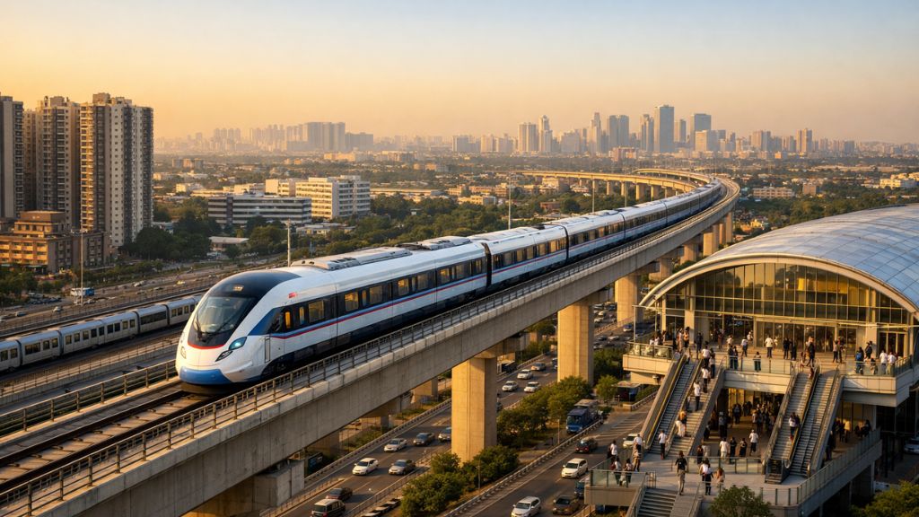
Table of Contents
Strategic Overview of the Corridor
The corridor forms part of the broader Namo Bharat Regional Rapid Transit System (RRTS) network, which is being developed as a high-speed rail-based regional connectivity framework across NCR.
Spanning approximately 61.5–64 km, the alignment is designed for high-speed operations with trains capable of reaching up to ~160 km/h, while maintaining an average operational speed in the 60–90 km/h range depending on station spacing and urban density.
A key design characteristic is its mixed elevation profile, with significant portions elevated to reduce land acquisition constraints and minimize interference with existing urban infrastructure.
The corridor is broadly divided into:
- ~52 km in Haryana (Gurugram–Faridabad segment)
- ~12 km in Uttar Pradesh (Faridabad–Noida–Greater Noida extension)
This interstate configuration positions the corridor as a critical east–west mobility spine linking employment hubs, residential clusters, and upcoming airport infrastructure.
Route Alignment and Urban Connectivity
The proposed alignment creates a continuous mobility chain connecting three major urban systems.
Gurugram Sector (Western Anchor)
The corridor begins in the Gurugram region around IFFCO Chowk and extends through key urban sectors such as Sector-29, Ghata Chowk, Sector-61, and Gwal Pahari along the Gurugram–Faridabad Road (MDR-137). This stretch serves dense commercial and mixed-use developments, including corporate offices and hospitality clusters.
Faridabad Urban Belt (Central Segment)
Entering Faridabad, the corridor passes through Sainik Colony, Badhkal Enclave, NIT Faridabad, and Bata Chowk, continuing through Sector-12, 13, 14, and 15. This segment is particularly significant due to its integration potential with the Delhi Metro Violet Line at Bata Chowk and its proximity to industrial and institutional zones.
Noida–Greater Noida Extension (Eastern Anchor)
From Faridabad, the alignment extends into Uttar Pradesh, passing through emerging urban nodes such as Siddharth Vihar, Char Murti Chowk, Knowledge Park, Surajpur, Alpha sectors, and Yamuna City sectors, ultimately connecting toward the influence zone of Noida International Airport (Jewar).
This eastern extension strategically links future aviation infrastructure with established IT, education, and residential hubs.
Station Planning and Functional Design
The station architecture reflects a hybrid mobility model combining regional rapid transit with metro-style accessibility.
1. Integrated Interchange Hubs
Key nodes such as IFFCO Chowk and Sector-61 are planned as multimodal interchange stations. These will connect:
- Delhi Metro Yellow Line
- Gurugram Rapid Metro
- Namo Bharat RRTS services
Sector-61 is also proposed to include a short connector link to integrate with the Rapid Metro system, enabling seamless passenger transfer across networks.
2. Urban Metro-Serving Stations in Gurugram and Faridabad
Between Gurugram and Faridabad, multiple metro-style stations are planned to function as high-frequency local stops. These stations are expected to serve dense residential belts, office clusters, and retail corridors while RRTS trains bypass select stations for faster regional travel.
3. Faridabad Transit Nodes
In Faridabad, stations around NIT, Bata Chowk, and Sector-12 to Sector-15 are designed to act as urban mobility anchors. This segment is particularly important for integrating industrial workforce mobility with regional commuting.
4. Noida–Greater Noida Stations
The eastern segment is expected to include strategic nodes near Knowledge Park, Surajpur/Alpha clusters, and Yamuna City, with a focus on future expansion toward airport-linked connectivity.
Dual-Mode Operations: A Hybrid Transit Innovation
One of the most distinctive features of this corridor is its planned dual-service model:
- RRTS (Namo Bharat) trains will operate as high-speed regional services with limited stops, connecting major nodes across NCR in under an hour-long travel span.
- Metro-style services will run on the same infrastructure, serving shorter intra-city trips with frequent stops.
This shared-track model is a cost-efficient infrastructure strategy, reducing the need for parallel metro corridors while maximizing corridor utility across different travel behaviors.
Read More: Impact of Dwarka Expressway on Real Estate of Delhi NCR
Project Scale, Cost, and Timeline Outlook
| Aspect | Details |
|---|---|
| Total Length | ~64 km (approx. 61.5–64 km range) |
| Geographic Split | ~52 km Haryana, ~12 km Uttar Pradesh |
| Estimated Cost | ₹15,000–₹15,700 crore (indicative range) |
| Construction Start | Expected 2026–2027 (post DPR & approvals) |
| Operational Target | 2030–2031 (subject to execution timelines) |
The timeline reflects the complexity of land acquisition, inter-state coordination, and integration with existing metro systems.
Travel Time Transformation and Network Integration
The corridor is expected to significantly compress travel times across NCR:
- Gurugram–Faridabad: reduced to ~20–25 minutes from the current 60–90 minutes during peak congestion
- Gurugram–Noida: expected under 60 minutes with integrated interchange travel
- Seamless linkage with Delhi Metro, Gurugram Rapid Metro, and future metro extensions enhances last-mile connectivity
Integration with aviation infrastructure is particularly important, connecting:
- Indira Gandhi International Airport (Delhi)
- Noida International Airport (Jewar)
This positions the corridor as a multi-airport connector spine within NCR.
Read More: Noida vs Gurgaon: Which City Offers Better Real Estate Opportunities?
Real Estate and Urban Development Impact
From a development perspective, the corridor is expected to trigger strong transit-oriented development (TOD) effects along its entire alignment.
High-impact micro-markets include:
- Gurugram outer sectors (29, 58–61, Gwal Pahari belt)
- Faridabad NIT–Bata Chowk–Sector 12–15 corridor
- Noida–Greater Noida Knowledge Park and Surajpur clusters
Historically, similar RRTS and metro expansions have led to:
- Increased land value within 1–1.5 km radius of stations
- Shift from low-density to mixed-use redevelopment
- Stronger demand for rental housing near transit corridors
- Commercial clustering around interchange nodes
This corridor is expected to reinforce NCR’s evolution into a polycentric urban structure rather than a Delhi-centric model.
Read More: Gurugram Real Estate: Luxury Real Estate Market Demand in the Future
Conclusion
The Noida–Faridabad–Gurugram Namo Bharat RRTS corridor is more than a transport project—it is a long-term urban restructuring instrument. By linking key economic zones, integrating multiple metro systems, and enabling airport-to-airport connectivity across NCR, it establishes a high-capacity backbone for future growth.
If executed as planned, it will significantly redefine commuting efficiency, accelerate real estate transformation, and strengthen NCR’s position as one of India’s most interconnected metropolitan regions.